
OpenStreetMap POI Search
Find parking, trailheads, restrooms, viewpoints — any OpenStreetMap point of interest — right on Cachly’s map with a q: query, online or offline.
How It Works
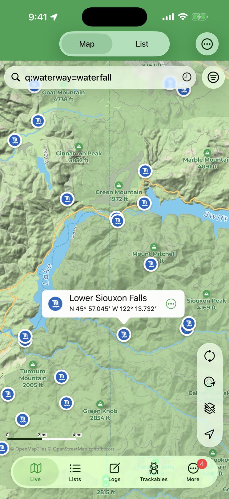
Geocaching is as much about the places around a cache as the cache itself — where to park, where the trail starts, whether there’s a restroom or a picnic table nearby. With a Pro Offline Map selected as your map source, the Live map’s search field can query OpenStreetMap points of interest directly. Type q: followed by an OpenStreetMap tag expression, for example q:amenity=parking, and tap Search on the keyboard. Cachly searches the visible map area, reports how many results it found, and drops a pin for each one with the matching map icon (a P for parking, a picnic table, a viewpoint…).
Queries use the Overpass turbo Wizard syntax. In short:
| Write | To match |
|---|---|
key=value | Features with that exact tag, e.g. amenity=toilets. |
key=* | Features that have the tag at all, whatever its value, e.g. historic=*. |
key!=value | Features whose tag is not that value. |
key~"text" | A regular-expression match on the value, e.g. name~"Park". |
a and b, a or b | Both conditions, or either one. Use parentheses to group: (a or b) and c. |
type:node, type:way | Restrict results to points (node) or lines and areas (way). Ways are pinned at their center. |
"quoted value" | Wrap a value in quotes if it contains a space or punctuation, e.g. name="Main Street". |
A query has to be a tag expression like the ones above. A bare word (q:parking) or a place phrase (q:parking around Denver) isn’t understood and Cachly reports a syntax error. To search somewhere else, pan the map there and search again. The OpenStreetMap Map Features page is the reference for tag names and values.
q: queries are answered by the public Overpass API, so they need an internet connection, and the search area is limited to what’s on screen. If a query is too broad for the area (thousands of results) it can time out — zoom in or add a condition. If the current map source isn’t a Pro Offline Map, Cachly reminds you that queries can only be used with Pro Offline Maps.Viewing a POI
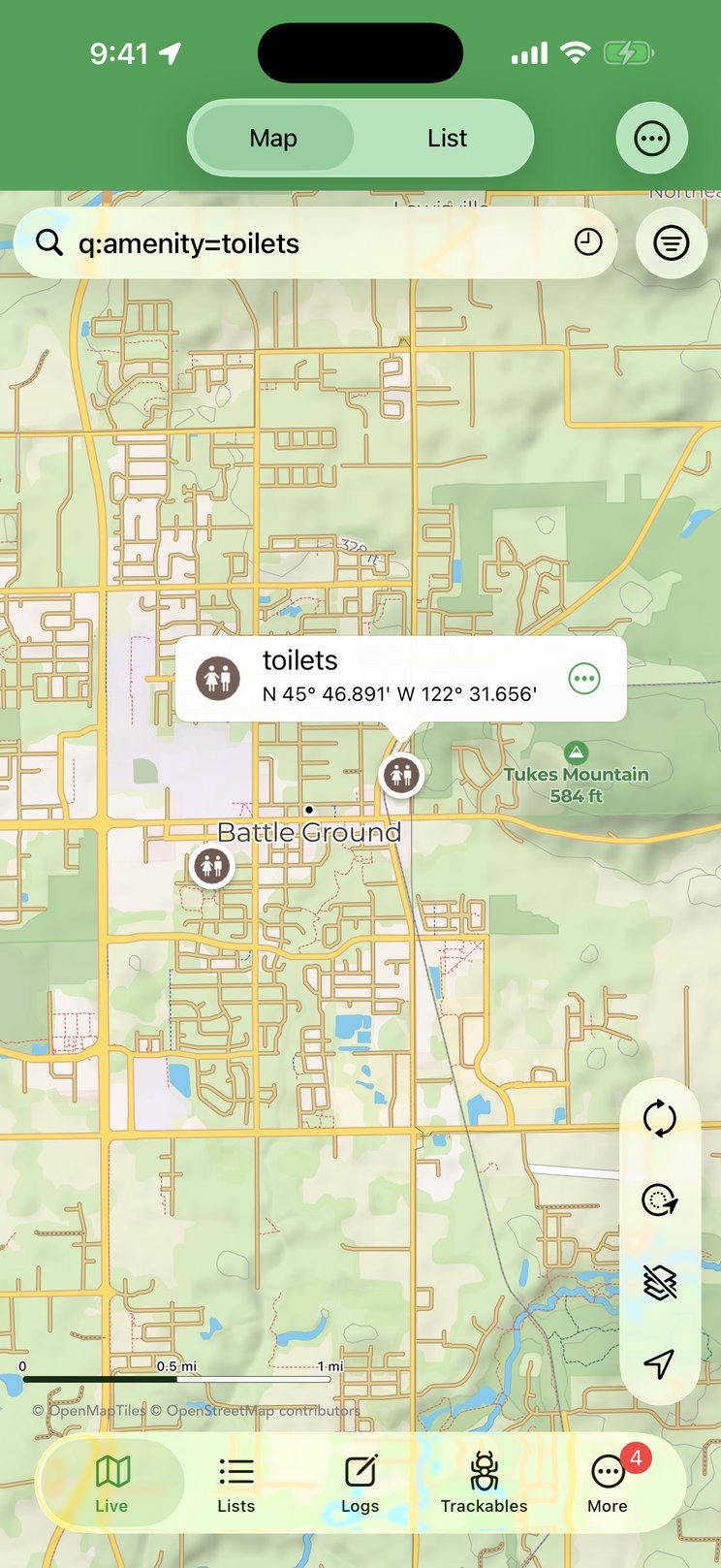
Tap a result pin to open its callout: the feature’s icon, its name (or its feature type when it has no name) and its coordinates. The ⋯ button on the callout opens a menu:
- Tags — opens a screen listing every OpenStreetMap tag on the feature as key and value pairs: opening hours, website, phone, fee, surface, wheelchair access, operator… whatever the mappers recorded. Long-press a row to copy its value.
- Create Offline Geocache — turns the POI into an offline geocache at those coordinates so you can save it to a list and navigate to it later.
- Navigate to Location — opens the compass/navigation map to the POI.
- Remove — takes that pin off the map.
Result pins stay on the map — alongside your caches, and across searches for caches — until you run another q: query (which replaces them) or remove them individually.
Example Queries
These are geared toward a day of caching. Each was checked against live OpenStreetMap data — try them as written, then swap in your own tags:
| Query | Finds |
|---|---|
q:amenity=parking | Parking lots — find somewhere to leave the car near ground zero. |
q:amenity=parking and fee=no | Only parking that’s tagged as free. |
q:amenity=toilets | Public restrooms. |
q:amenity=drinking_water | Drinking fountains and taps along the route. |
q:leisure=picnic_table or amenity=bench | Somewhere to sit and sign the log. |
q:tourism=information and information=board | Information boards — the classic spot for a cache hint or a trailhead map. |
q:historic=* | Anything historic: memorials, monuments, plaques, ruins, old buildings — prime cache territory. |
q:historic=memorial or historic=monument | Just memorials and monuments. |
q:tourism=viewpoint or natural=peak | Viewpoints and summits — where the terrain-5 caches live. |
q:man_made=survey_point | Survey markers — the benchmarks many cachers still hunt. |
q:bridge=* and type:way | Bridges, pinned at their midpoint — a favorite hiding place. |
q:name~"Park" and type:node | Named points with “Park” in the name; ~ is a regular-expression match. |
q:waterway=waterfall | Waterfalls — scenic cache spots and worth the detour on their own. |
q:amenity=cafe | Coffee for afterward. |
Searching POIs Offline
When you have no signal, the downloaded map itself can be searched. Turn on Offline Searching under More › Settings › Cachly Pro › Pro Offline Maps (or long-press the layers button on the map and flip it in the menu’s Options). The search field’s placeholder changes to Offline: Locations, Features, Coordinates. Now type a plain word — no q: prefix — such as parking, trailhead, viewpoint, picnic or the name of a park, and Cachly scans the map data on your device for matching features within the visible area. Results appear in a panel sorted by distance, each with its icon and feature type, and offer the same Tags, Create Offline Geocache and Navigate to Location menu. Offline searching needs the map zoomed in past about zoom level 8, a search term of at least three characters, and a single offline map loaded. See Offline Map Searching for the details.