
Offline Maps & Downloads
Offline maps let the base map render with no connection — the other half of caching off-grid (the first half being offline lists). Most offline map capabilities are part of Cachly Pro.
Pro Offline Maps PRO
Cachly Pro’s offline maps are worldwide vector maps built from OpenStreetMap data and optimized for readability. Download them via the map-layers icon or Settings › Cachly Pro › Download Offline Maps. Maps update every week. Features include:
- Contours & hillshades as supplementary downloads, switching with your metric/imperial units.
- Customizable layer visibility — trails, 3D buildings, points of interest — and 3D map rendering.
- Local place names — turn on Use Local Place Names in the layer options to label cities and places in each country’s own language — Wien, Praha, Milano — matching the road signs around you instead of your device language.
- County lines & names for US states and comparable international regions — visible even at low zoom, so nearly a whole state’s county lines fit on screen.
- Trail symbols & colors from OpenStreetMap, plus optional bold road color schemes designed to match UK Ordnance Survey styling.
Missing a Trail? Improve the Map Yourself
Points of Interest & Their Icons PRO
Pro Offline Maps label points of interest with their own icons, colored by category — blue for transport, green for parks and outdoors, brown for culture and civic places, orange for food and drink, red for health and hazards, and so on. Here are all 129 POI icons you’ll see on the map:
 Aerialway
 Airfield
 Airport
 Alcohol shop
 American football
 Amusement park
 Aquarium
 Art gallery
 Attraction
 Bakery
 Bank
Bank Bar
Bar Baseball
 Basketball
 BBQ
BBQ Beachvolleyball
 Beer
Beer Bicycle
 Bicycle parking
 Bicycle rental
 Building
 Bus
Bus Butcher
 Cafe
Cafe Campsite
 Car
Car Casino
 Castle
 Cave entrance
 Cemetery
 Charging station
 Cinema
 Cliff
Cliff Clothing store
 College
 Commercial
 Cricket
 Dam
Dam Danger
 Dentist
 Doctor
 Dog park
 Drinking water
 Embassy
 Entrance
 Fast food
 Ferry
Ferry Fire station
 Flower
 Fuel
Fuel Garden
 Gate
Gate Geocaching
 Gift
Gift Golf
Golf Grocery
 Hairdresser
 Harbor
 Heliport
 Horse racing
 Hospital
 Ice cream
 Industry
 Information
 Laundry
 Library
 Lighthouse
 Lodging
 Marine
 Military
 Monument
 Motor
Motor Motorcycle parking
 Mountain
 Museum
 Music
Music National
 Native lands
 Park
Park Parking
 Pharmacy
 Picnic site
 Pitch
Pitch Place of worship
 Playground
 Police
 Post
Post Prison
 Railway
 Light rail
 Metro / subway
 Ranger station
 Recycling
 Christian worship
 Jewish worship
 Muslim worship
 Restaurant
 Roadblock
 Rocket
 Ruins
Ruins School
 Shelter
 Shop
Shop Skateboard
 Skiing
 Soccer
 Stadium
 Stream
 Suitcase
 Sushi
Sushi Swimming
 Telephone
 Tennis
 Theatre
 Theme park
 Toilets
 Toll booth
 Town hall
 Trail
Trail Veterinary
 Volcano
 Volleyball
 Warehouse
 Waste basket
 Water
Water Waterfall
 Wetland
 Wheelchair
 Zoo
Zoo
Map Styles PRO
Beyond the POI icons, Pro Offline Maps draw roads, paths, water, terrain and land use with a consistent visual language, grouped by type below. Each swatch shows the element’s color and line weight at a typical zoom level (widths scale as you zoom in and out). Where the map would label a feature, the swatch includes an example name — road names in brown with a white halo, trail and path names in bold white with a dark halo, and route numbers in shields — drawn exactly as they appear on the map. The optional UK Ordnance Survey bold road scheme recolors the main roads; its variants are shown at the end.
Roads
 Motorway
 Motorway link
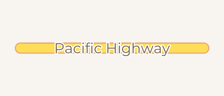 Trunk road
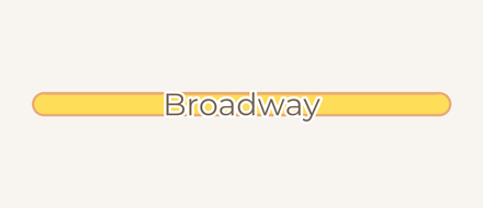 Primary road
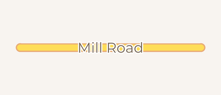 Secondary road
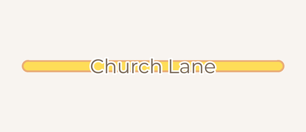 Tertiary road
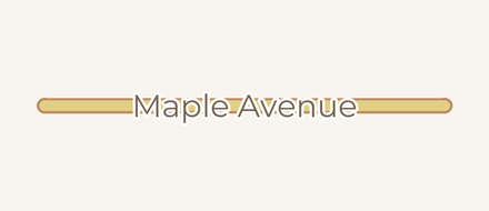 Minor / residential
 Service / alley
 Link road
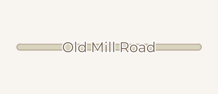 Unpaved road
 Under construction
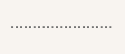 Access road
Paths & trails
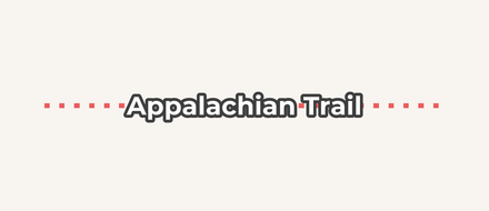 Path / trail
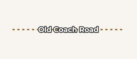 Track
Track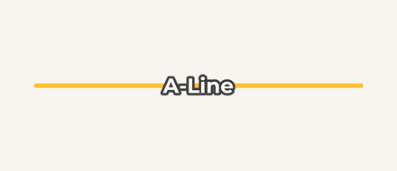 Mountain-bike trail
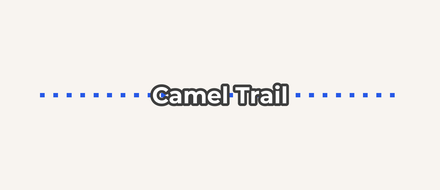 Cycle path
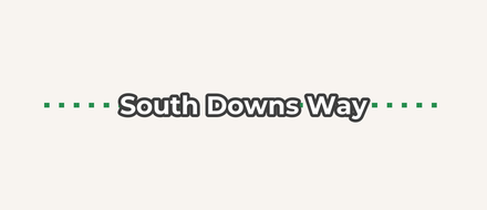 Bridleway
 Sidewalk
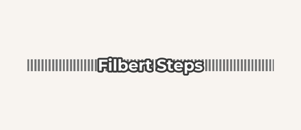 Steps
Steps Raceway
 Motocross track
 Pedestrian area
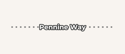 Waymarked route
Rail, air & ferry
 Railway
 Subway
 Service rail
 Ferry route
 Pier
Pier Airport runway
 Power line
 Airport taxiway
 Helipad
 Airport apron
 Airport surface
Water
 Ocean / lake
 River
River Stream
 Canal / waterway
 Dam
Dam Basin / reservoir
 Lake / pond
 Ditch / drain
Land cover
 Woodland / forest
 Grassland
 Wetland
 Farmland
 Bare rock
 Scree
Scree Sand / beach
 Glacier / ice
 Quarry
 Ice shelf
Land use
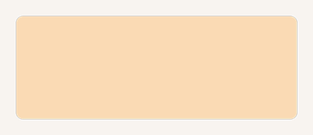 Residential area
 Commercial area
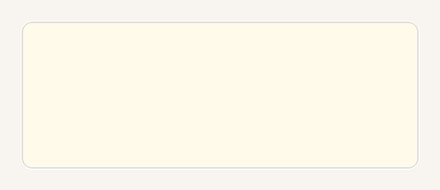 Industrial area
 Cemetery
 Hospital grounds
 School grounds
 Military area
 Parking lot
 Aerodrome
 Winter sports
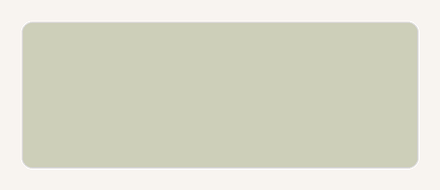 Landfill
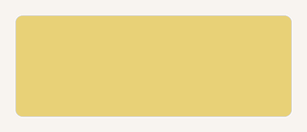 Power station
 Indigenous / protected land
 Railway land
Parks & recreation
 Park
Park National / protected park
 Sports pitch
 Playground
 Sports centre
 Protected area
 Marine park
 Military training area
 Park grass
Buildings & boundaries
 Building
 Country boundary
 State / province boundary
 County boundary
 Ceremonial county (England)
Contours
 Contour (major)
 Contour (minor)
 Contour (index)
 Contour (standard)
Skiing
 Downhill ski run
 Nordic ski trail
 Winter hiking trail
 Ski lift
Barriers, walls & cliffs
 Cliff / ridge
 Fence
Fence City wall
 Castle wall
 Castle grounds
 Ruins
Ruins
Reference lines
 Latitude / longitude line
 Equator
UK Ordnance Survey bold roads
 Motorway
 Motorway link
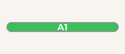 Trunk road
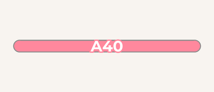 Primary road
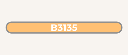 Secondary road
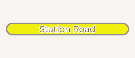 Tertiary road
 Minor road
Route Symbols PRO
Waymarked hiking and cycling routes are drawn from their OpenStreetMap osmc:symbol tag, which Cachly builds in different configurations: a trail color for the route line, plus an optional route symbol made of a background shape and a foreground mark, each in its own color. The symbols below are grouped by color.
Trail colors — the color of the route line on the map
 Blue
Blue White
White Yellow
 Red
Red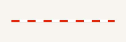 Red / white
 Purple
 Orange
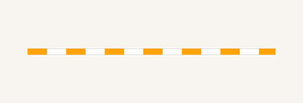 Orange / white
 Green
Green Brown
Brown
These are the colors you’ll see most often, but they are not the only ones. The osmc:symbol tag allows many other color combinations — different pairings of line color, background and foreground — and Cachly renders those too, so a route in your area may use a combination not pictured here.
Red
 Solid background
 Circle background
 Frame background
 Round background
 Bar
Bar Lower bar
 Stripe
 Cross
Cross X
X Slash
Slash Backslash
 Dot
Dot Circle
 Rectangle
 Rectangle (outline)
 Triangle
 Triangle (outline)
 Triangle (inverted)
 Diamond
 Diamond (outline)
 Corner
 Pointer
 Right arrow
 Arch
Arch Fork
Fork Hexagon
 Wheel
Wheel Hiker
Hiker Shell
Shell Modern shell
 Red diamond
 Turned T
Blue
 Solid background
 Circle background
 Frame background
 Round background
 Bar
Bar Lower bar
 Stripe
 Cross
Cross X
X Slash
Slash Backslash
 Dot
Dot Circle
 Rectangle
 Rectangle (outline)
 Triangle
 Triangle (outline)
 Triangle (inverted)
 Diamond
 Diamond (outline)
 Corner
 Pointer
 Right arrow
 Arch
Arch Fork
Fork Hexagon
 Wheel
Wheel Hiker
Hiker Shell
Shell Modern shell
 Red diamond
 Turned T
Green
 Solid background
 Circle background
 Frame background
 Round background
 Bar
Bar Lower bar
 Stripe
 Cross
Cross X
X Slash
Slash Backslash
 Dot
Dot Circle
 Rectangle
 Rectangle (outline)
 Triangle
 Triangle (outline)
 Triangle (inverted)
 Diamond
 Diamond (outline)
 Corner
 Pointer
 Right arrow
 Arch
Arch Fork
Fork Hexagon
 Wheel
Wheel Hiker
Hiker Shell
Shell Modern shell
 Red diamond
 Turned T
Yellow
 Solid background
 Circle background
 Frame background
 Round background
 Bar
Bar Lower bar
 Stripe
 Cross
Cross X
X Slash
Slash Backslash
 Dot
Dot Circle
 Rectangle
 Rectangle (outline)
 Triangle
 Triangle (outline)
 Triangle (inverted)
 Diamond
 Diamond (outline)
 Corner
 Pointer
 Right arrow
 Arch
Arch Fork
Fork Hexagon
 Wheel
Wheel Hiker
Hiker Shell
Shell Modern shell
 Red diamond
 Turned T
Orange
 Solid background
 Circle background
 Frame background
 Round background
 Bar
Bar Lower bar
 Stripe
 Cross
Cross X
X Slash
Slash Backslash
 Dot
Dot Circle
 Rectangle
 Rectangle (outline)
 Triangle
 Triangle (outline)
 Triangle (inverted)
 Diamond
 Diamond (outline)
 Corner
 Pointer
 Right arrow
 Arch
Arch Fork
Fork Hexagon
 Wheel
Wheel Hiker
Hiker Shell
Shell Modern shell
 Red diamond
 Turned T
Purple
 Solid background
 Circle background
 Frame background
 Round background
 Bar
Bar Lower bar
 Stripe
 Cross
Cross X
X Slash
Slash Backslash
 Dot
Dot Circle
 Rectangle
 Rectangle (outline)
 Triangle
 Triangle (outline)
 Triangle (inverted)
 Diamond
 Diamond (outline)
 Corner
 Pointer
 Right arrow
 Arch
Arch Fork
Fork Hexagon
 Wheel
Wheel Hiker
Hiker Shell
Shell Modern shell
 Red diamond
 Turned T
Brown
 Solid background
 Circle background
 Frame background
 Round background
 Bar
Bar Lower bar
 Stripe
 Cross
Cross X
X Slash
Slash Backslash
 Dot
Dot Circle
 Rectangle
 Rectangle (outline)
 Triangle
 Triangle (outline)
 Triangle (inverted)
 Diamond
 Diamond (outline)
 Corner
 Pointer
 Right arrow
 Arch
Arch Fork
Fork Hexagon
 Wheel
Wheel Hiker
Hiker Shell
Shell Modern shell
 Red diamond
 Turned T
Black
 Solid background
 Circle background
 Frame background
 Round background
 Bar
Bar Lower bar
 Stripe
 Cross
Cross X
X Slash
Slash Backslash
 Dot
Dot Circle
 Rectangle
 Rectangle (outline)
 Triangle
 Triangle (outline)
 Triangle (inverted)
 Diamond
 Diamond (outline)
 Corner
 Pointer
 Right arrow
 Arch
Arch Fork
Fork Hexagon
 Wheel
Wheel Hiker
Hiker Shell
Shell Modern shell
 Red diamond
 Turned T
Gray
 Solid background
 Circle background
 Frame background
 Round background
 Bar
Bar Lower bar
 Stripe
 Cross
Cross X
X Slash
Slash Backslash
 Dot
Dot Circle
 Rectangle
 Rectangle (outline)
 Triangle
 Triangle (outline)
 Triangle (inverted)
 Diamond
 Diamond (outline)
 Corner
 Pointer
 Right arrow
 Arch
Arch Fork
Fork Hexagon
 Wheel
Wheel Hiker
Hiker Shell
Shell Modern shell
 Red diamond
 Turned T
White
 Solid background
 Circle background
 Frame background
 Round background
 Bar
Bar Lower bar
 Stripe
 Cross
Cross X
X Slash
Slash Backslash
 Dot
Dot Circle
 Rectangle
 Rectangle (outline)
 Triangle
 Triangle (outline)
 Triangle (inverted)
 Diamond
 Diamond (outline)
 Corner
 Pointer
 Right arrow
 Arch
Arch Fork
Fork Hexagon
 Wheel
Wheel Hiker
Hiker Shell
Shell Modern shell
 Red diamond
 Turned T
No color specified
 Bar
Bar Lower bar
 Stripe
 Cross
Cross X
X Slash
Slash Backslash
 Dot
Dot Circle
 Rectangle
 Rectangle (outline)
 Triangle
 Triangle (outline)
 Triangle (inverted)
 Diamond
 Diamond (outline)
 Corner
 Pointer
 Right arrow
 Arch
Arch Fork
Fork Hexagon
 Wheel
Wheel Hiker
Hiker Shell
Shell Modern shell
- Red diamond
 Turned T
Offline Map Searching PRO
When an offline map is active on the Live tab, Cachly can search map features completely offline, within your currently visible screen area — zoom to frame your target region first. Toggle it on under Settings; enable Allows Partial Words so searching “water” matches waterfall and waterway. There’s also a quick toggle right on the map: long-press the layers button and flip Offline Searching in the Options of the menu that appears — a checkmark shows its state, and the search field’s placeholder switches to Offline: Locations, Features, Coordinates so you always know which kind of search you’re about to run. For structured point-of-interest queries by OpenStreetMap tag (parking, drinking water, bus stops…), see OSM POI Search. Result names follow the Use Local Place Names layer option, so what you find matches what the map shows.
Downloading a Region
Choose a region to download; Cachly fetches it in the background (a background session keeps large downloads going even if you leave the app). The Downloads screen shows progress and manages what you’ve saved.
Custom Tile URLs
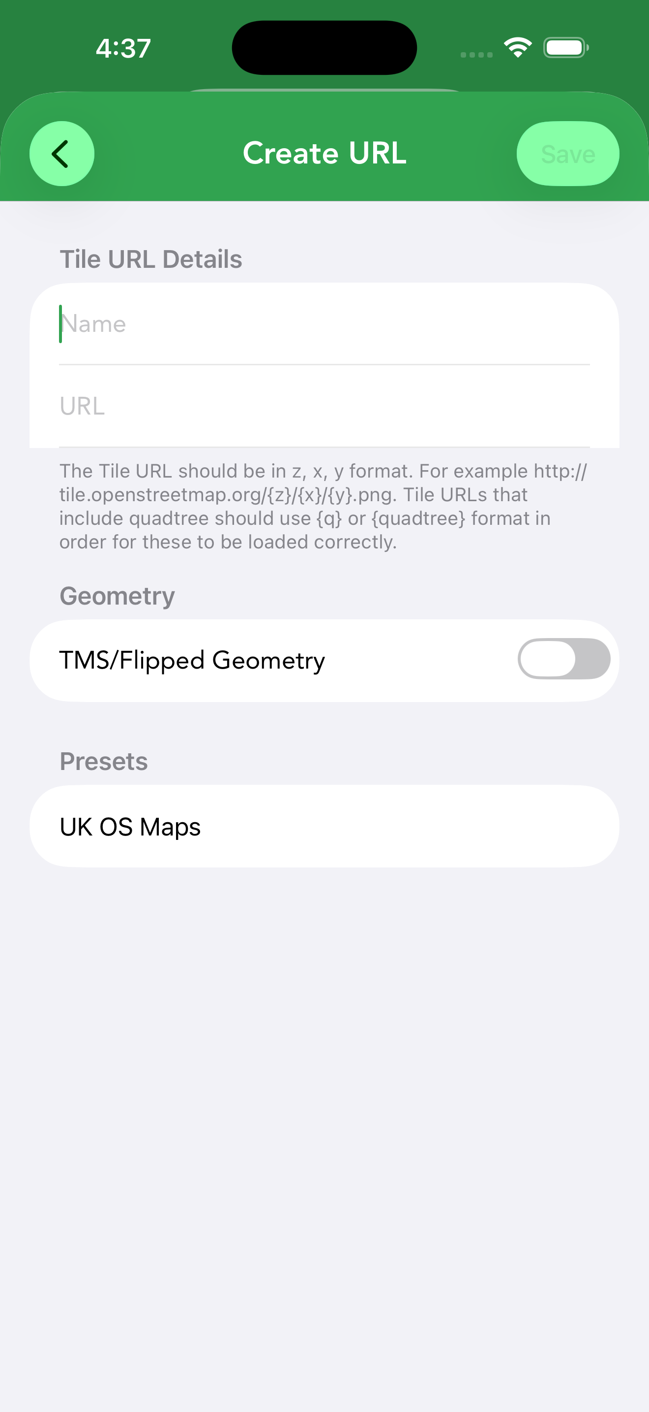
Beyond the built-in sources, Cachly can load tiles from any tile server — specialist commercial maps or free ones (many free servers require your own API key). Open the Map Types panel, scroll to Custom Tile URLs and tap Add Custom Tile URL.
On the Tile URL Details screen, give the source a name and enter its URL template in z/x/y format — for example https://{s}.tile.openstreetmap.org/{z}/{x}/{y}.png:
{z},{x},{y}— zoom level and tile coordinates (required).{s}— rotates across the server’s subdomains.{q}or{quadtree}— for servers that address tiles with a quadtree key instead of z/x/y.
Under Geometry, enable TMS / Flipped Geometry for servers whose y-axis runs the other way (TMS layout). A Presets section offers ready-made configurations — such as UK OS Maps — so common services need no manual setup. Saved sources appear in the Map Types panel like any other map, and can be edited or removed later.