
Settings
Settings (in the More tab) is where you tailor Cachly to how you cache. The screen is searchable — type in the search box at the top to jump to an option by name — and is organized into the categories below.
How Settings Is Organized
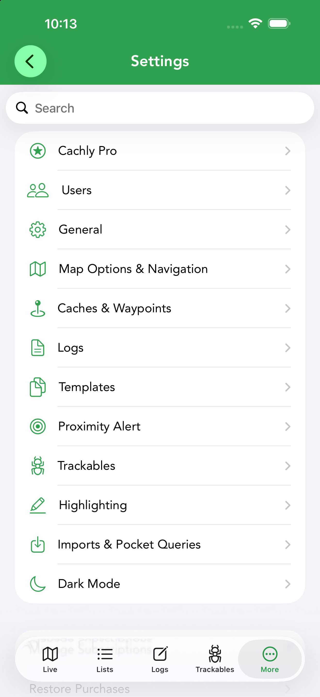
The Settings root screen lists twelve categories: Cachly Pro, Users, General, Map Options & Navigation, Caches & Waypoints, Logs, Templates, Proximity Alert, Trackables, Highlighting, Imports & Pocket Queries and Dark Mode. Each is covered below.
Beneath the categories are Manage Subscriptions (opens your Apple ID subscription management) and Restore Purchases, which re-activates a Cachly Pro subscription after a reinstall or on a new device.
Below those is Remove State Restoration Data. Cachly remembers which screens you had open — the cache, list or search you were looking at — so it can put you back there when you relaunch. If the app keeps reopening to a screen you don’t want, or something goes wrong on launch, tap this row and confirm Remove to clear that saved state; the next launch starts fresh on the main tabs. Your caches, lists, logs and settings are not affected.
Cachly Pro PRO
Everything tied to your Pro subscription lives here, grouped by feature:
- Cachly Intelligence — enable AI features, pick the AI Provider (Apple Intelligence, Claude, ChatGPT, Gemini, Mistral), choose the Log Language that generated logs are written in, and edit the Log Summary, Description Summary and Log Writing prompts. See Cachly Intelligence.
- Pro Offline Maps — Download Offline Maps, Layer Options, Offline Searching (search map features within the screen bounds, with Allow Partial Words to match on partial words) and Counties & Regions, where Default Country Selection sets the country used when importing county and region challenge maps. See Offline Maps.
- Automatically Add Finds — add finds made in Cachly to your Counties and DeLorme challenge maps automatically.
- Automatically Load Caches — Use Auto Load Caches loads new caches as you move around the live map. While it’s on, Show Adventure Labs and Show Adventure Labs Stages toggles appear beneath it; they only apply to auto-loading, so they’re hidden when Use Auto Load Caches is off.
- CarPlay — microphone and speech-recognition permissions used for voice logging in the car.
Users
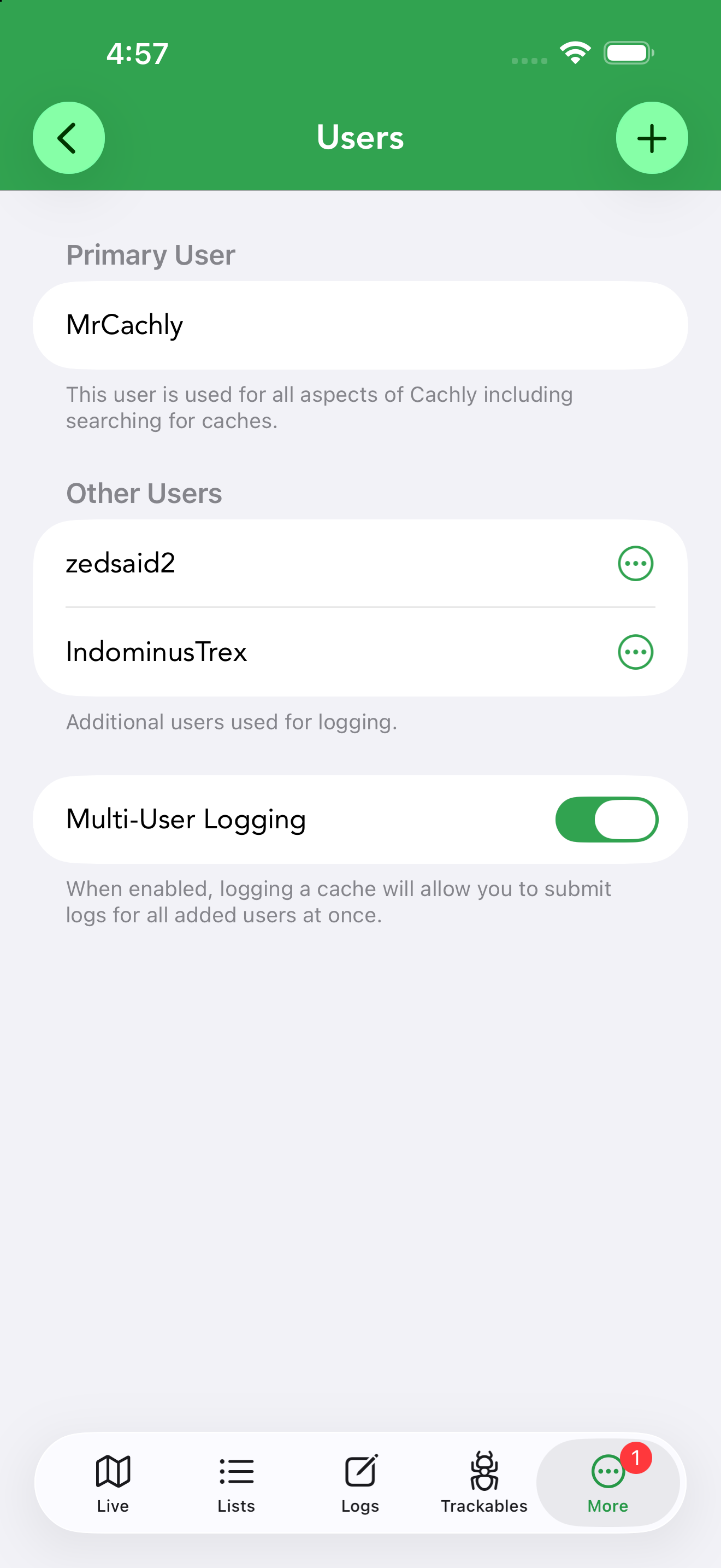
Your Primary User is the account used for all aspects of Cachly, including searching for caches. You can add additional users here so a group caching together can log finds under several accounts at once — see multi-user logging. If an added account’s session expires, return to Settings › Users to sign it in again.
General
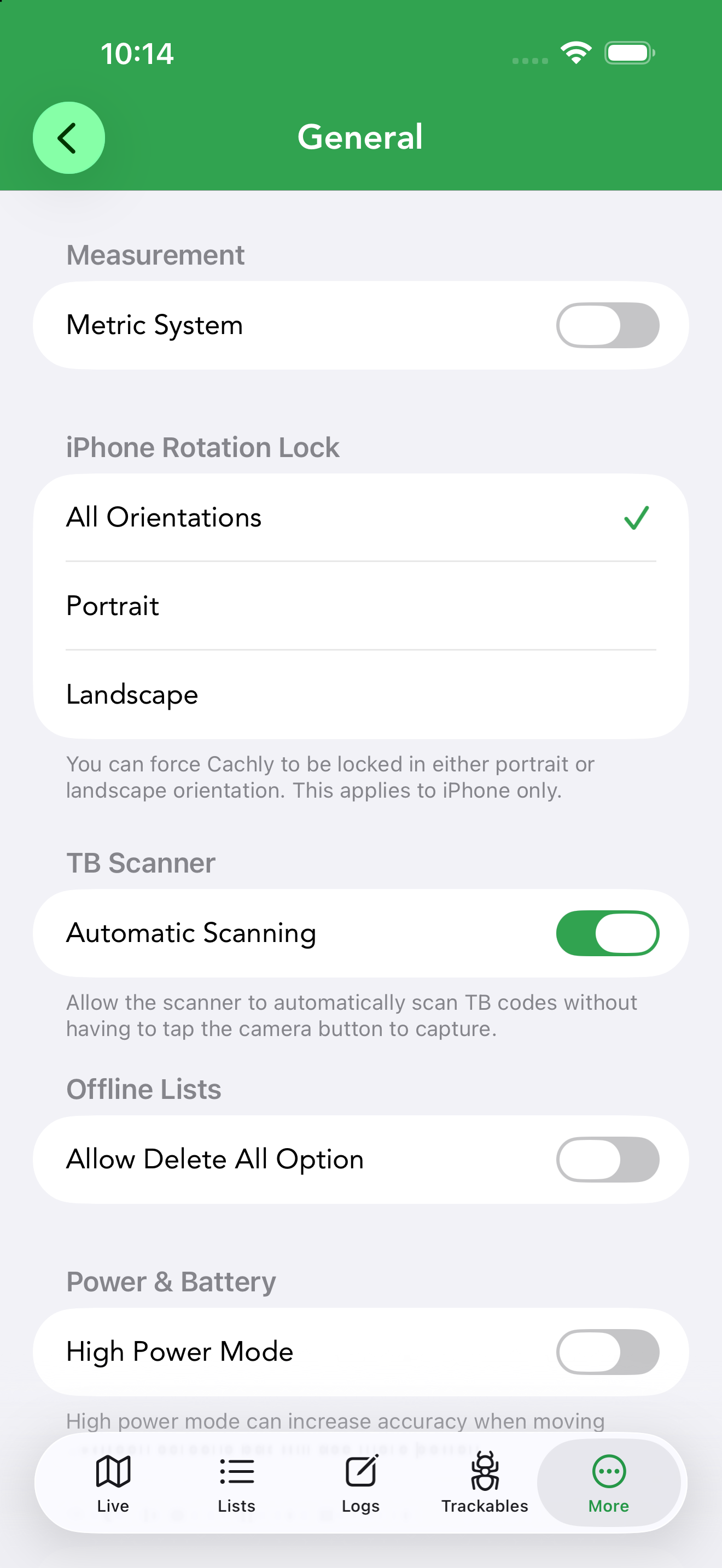
App-wide preferences, from units to power use:
- Measurement — switch between Metric and imperial units.
- iPhone Rotation Lock — All Orientations, Portrait or Landscape (iPhone only).
- TB Scanner — Automatic Scanning reads trackable codes without tapping the capture button.
- Offline Lists — Allow Delete All Option, off by default; enable it to show the Delete All action on offline lists (a guard against accidental bulk deletion).
- Power & Battery — High Power Mode improves GPS accuracy when moving between screens at the cost of battery.
- Default Coordinate Format — the format used when copying coordinates: DDM (N 47° 38.938’), decimal degrees, UTM, Copy Presented Format, or Use Coordinate Picker to choose each time. See coordinate formats.
- Sorting — Re-sort on Location Updates keeps distance-sorted lists in order as you move.
- Clipboard — Detect Geocache Links. With a geocaching.com or coord.info link on the clipboard, opening Cachly asks “Geocache Link Found — would you like to view GC…?” and View takes you straight to that cache. Cachly only checks whether iOS reports a web link on the clipboard, so it never reads clipboard text you haven’t chosen to open. Turn the switch off to stop the prompt entirely.
- Other — Decode Hint (auto-decrypt ROT13 hints) and Delete Offline Upvote Counts.
Map Options & Navigation
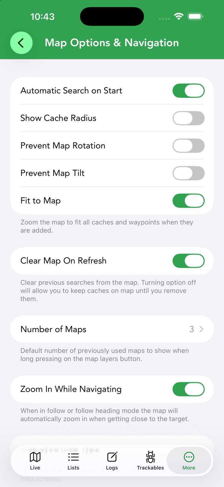
Controls how the map behaves and which app handles driving directions:
- Map behavior — Automatic Search on Start, Show Cache Radius, Prevent Map Rotation / Prevent Map Tilt, Fit to Map (zoom to fit all caches and waypoints) and Clear Map On Refresh (turn off to keep previous searches on the map).
- Number of Maps — how many recently used maps appear when you long-press the map-layers button.
- Zoom In While Navigating — in follow / follow-heading mode, automatically zoom in as you close on the target.
- Displayed Map Type — the map type used across all map screens.
- World Landcover and Hillshades PRO — Landcover and Hillshades layers for Pro maps (small bandwidth use, online only), plus Tile URLs 2x Size for easier-to-read custom tiles.
- Map API Keys — some map sources need a free key, e.g. Open Cycle & Thunderforest.
The app used for driving directions isn’t a setting — you choose it each time from the navigation menu on the Navigate to Cache screen, which lists every supported routing app you have installed. CarPlay is the exception: it remembers the app you picked there as its default.
Caches & Waypoints
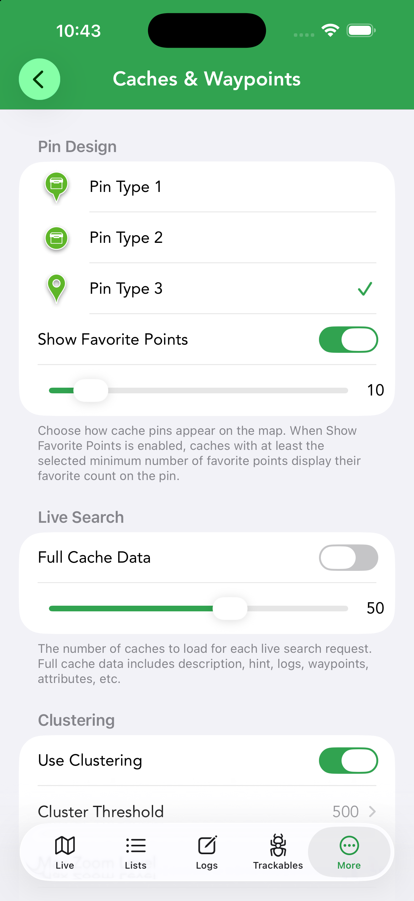
How caches and waypoints look and load:
- Pin Design — three pin styles, plus Show Favorite Points to display the favorite count on pins above a minimum you set.
- Adventure Labs — two switches, both off by default. Show Stage Indicator marks each Adventure Lab stage pin with a stage icon (on the map, in the list and in CarPlay); leave it off for plain Adventure Lab pins. Show Parent Adventure shows the parent Adventure on the map and in the cache list alongside its stages; leave it off to see only the stages. See Adventure Labs on the Live Map.
- Live Search — Full Cache Data (description, hint, logs, waypoints, attributes) and how many caches each live-search request loads.
- Clustering — Use Clustering with a Cluster Threshold and Max Zoom Level; reduces memory use when many caches are on the map. Restore Defaults resets these clustering values.
- Ignore Corrected Coordinates — show caches at their original rather than corrected coordinates.
- Waypoints — Show All Waypoints on the map, filterable by type (requires Full Cache Data for live caches), with Offline Lists Only to restrict the display to offline lists.
- Lonely Caches — mark caches unfound for a set Number of Days with a clock icon.
- Did Not Find (DNF) — Clear Pending DNF on Map and Show Cache Type on Map alongside the DNF marker.
- Found But Not Logged — Clear All Checkmarks, and the FTF Indicator that flags caches nobody has found yet.
Logs
Defaults for writing logs:
- Logging Defaults — choose whether new logs default to Send Log Now or Save as Draft, and set the default Log Type.
- Display — Recent Logs Use Smilies shows smiley/frown icons instead of colored dots in cache details.
Templates
Turn on Enable Text Templates to activate the feature, then create reusable text templates for your logs here — boilerplate like a thank-you line or your team sign-off. Templates can be inserted while writing a log or applied automatically by log type, and one can be marked the default.
Proximity Alert
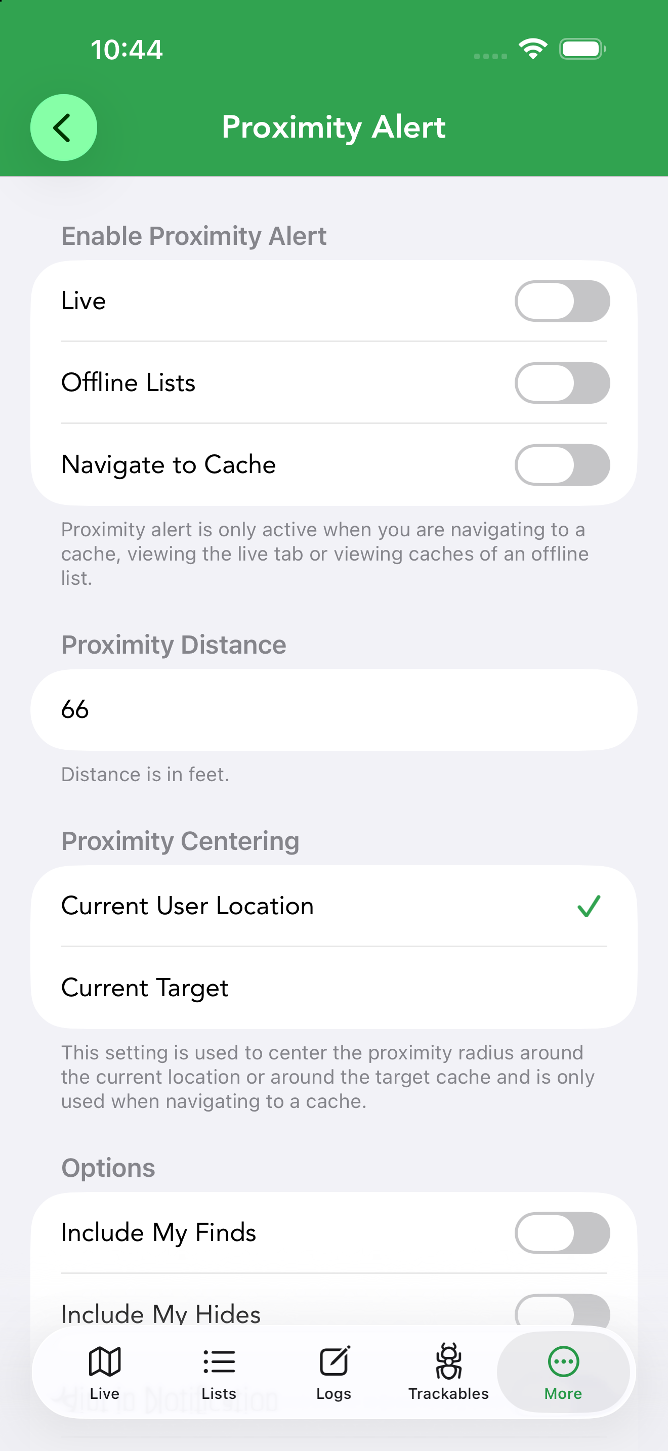
Cachly can play an audio alert and post a notification as you near a cache, so your phone can stay pocketed on the approach:
- Enable Proximity Alert — separately for the Live tab, Offline Lists and Navigate to Cache.
- Proximity Distance — the trigger radius (in feet).
- Proximity Centering — center the radius on your Current User Location or the Current Target (used when navigating to a cache).
- Options — Include My Finds, Include My Hides, Hint in Notification, and Notify For All Caches (alert for nearby caches, not just the target).
- Notification Sound — pick the alert sound.
Trackables
Automatically Visit lets trackables in your inventory be visited with each cache log: turn on Enable Auto-Visit, then pick which trackables under Auto-Visit Trackables (the row shows how many are selected). Applies to Found It, Attended and Webcam Photo Taken logs; see Auto-Visit for how the list is managed.
Highlighting
Maintenance tools for cache highlights:
- Manually Sync Highlights — fix highlights that got out of sync on offline lists after changes on another device.
- Remove By Color / Remove All Highlights — clear highlights, across all devices.
- Restore Caches From Highlights and Edit Highlight Color Labels — rebuild caches from your highlight records and rename what each color means.
Imports & Pocket Queries
Controls for GPX imports and pocket queries:
- Lock Corrected Coordinates / Lock Found Status — prevent imported GPX data from being overwritten when caches update.
- GSAK — User Flag Sets Highlight highlights caches whose GSAK user flag is set.
- Adventure Lab — Show Import Icon distinguishes imported Adventure Labs from API-loaded ones.
- Pocket Queries — Import Using Full Data brings in personal notes and corrected coordinates; turn it off for a faster GPX-only import.
Dark Mode
By default Cachly follows the iOS appearance. Dark Interface Style controls whether the app’s interface goes dark when iOS is in dark mode. When it’s on, a second toggle, Dark Map Styles, appears — turn it off to keep a light map under a dark interface (Dark Map Styles is only available while Dark Interface Style is enabled).